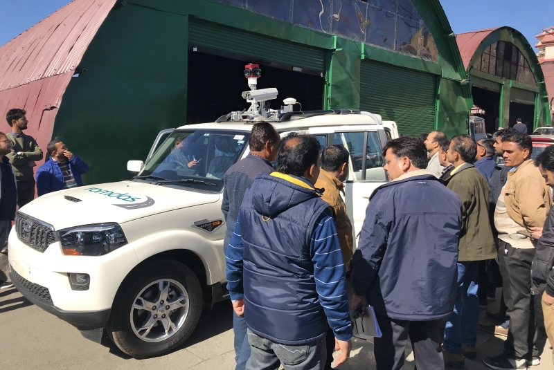
In recent news, ROMDAS engineers flew their way across the world to The Himalayas to implement a new pavement condition and mobile mapping vehicle for HPRIDC (Himachal Pradesh Road and other Infrastructure Development Corporation). The vehicle features roughness instruments capable of off-road use, Geometry in conjunction with our new mobile mapping module, which includes; a high-resolution 360-degree camera and a single right of way camera. Industry-leading state-of-the-art Mobile Mapping software is also included in this package.
Data processing is powered by ROMDAS DataView and top-tier mobile mapping software from industry leaders – HORUS. Paired with ROMDAS central system and modules, plug-ins for mobile mapping with HORUS will enable HPRIDC to easily create and edit detailed GIS maps and information of their roadside assets, hazards and more by recording accurate location and measurements directly from their survey videos.
This project has started in the Himalayas and will eventually cover many other regions of India. Focused heavily on road safety, HPRIDC will also undertake a project to measure landslides to increase road user safety in the harsh terrain of the mountains.
Our highly-experienced engineer, Krishna Jammalamadaka overcame the challenge of conducting testing in multiple zones within the state and dealing with heavy rain, high humidity and hot sun on a daily basis. Managing the logistics of the teams professionally, Krishna was able to train the HPRIDC team, along with Zonal engineers in several zones within the state.
When you see the HPRIDC team travelling through the beautiful Himalayan mountain zones, you can be sure they are there to make your travels safer, and easier, thanks to Krishna and the HPRIDC team and all others involved.