Leon Y Godoy Consultores are the latest customer to successfully implement our new Mobile Mapping module. This new method is very cost-effective and is more user friendly than the larger/more expensive LIDAR mobile mapping systems.
As most of you know, Ecuador suffered a devastating earthquake on April 16 2016. In July 2016, our engineer visited Quito, the capital city of Ecuador, to train a local team on the installation, operation and methodology for using this new system.
Now equipped with this new system, Leon Y Godoy Consultores intend on performing network level surveys throughout many provinces within Ecuador. They will use this system to create detailed GIS maps of asset & inventory data, including signs, culverts and other visible assets. The system also simultaneously collects Roughness (IRI) and road geometry data by utilizing a ROMDAS Bump Integrator and Geometry unit.
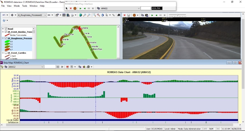
Leon Y Godoy Consultores can now easily deliver detailed Shape files to their clients, which are easily imported into their other 3rd party GIS Mapping software. In addition, their clients will also utilize the “integrated viewing” feature of our DataView software to simultaneously view all data, videos and GIS maps in the office. This will help reduce the need for site visits as clients can play the data as if sitting in the vehicle.

You can watch the Youtube video about ROMDAS Video Logging Systems here - https://www.youtube.com/watch?v=A3Cm2PmlIAk.
For more information about ROMDAS DataView you can vist this page of our website.
Thank you Leon Y Godoy Consultores for your hospitality during our visit and we look forward to supporting you during your upcoming projects.
