One of our Peruvian based customers is now able to calculate detailed measurements and record GPS locations of assets, inventory & pavement conditions directly from ROMDAS videos. Their ROMDAS system now includes an additional ROW camera and licenses of our new Mobile mapping software. This configuration allows them to offer new services that are very cost effective, safer and an efficient method when compared to manual field measurements or using expensive laser scanning systems.
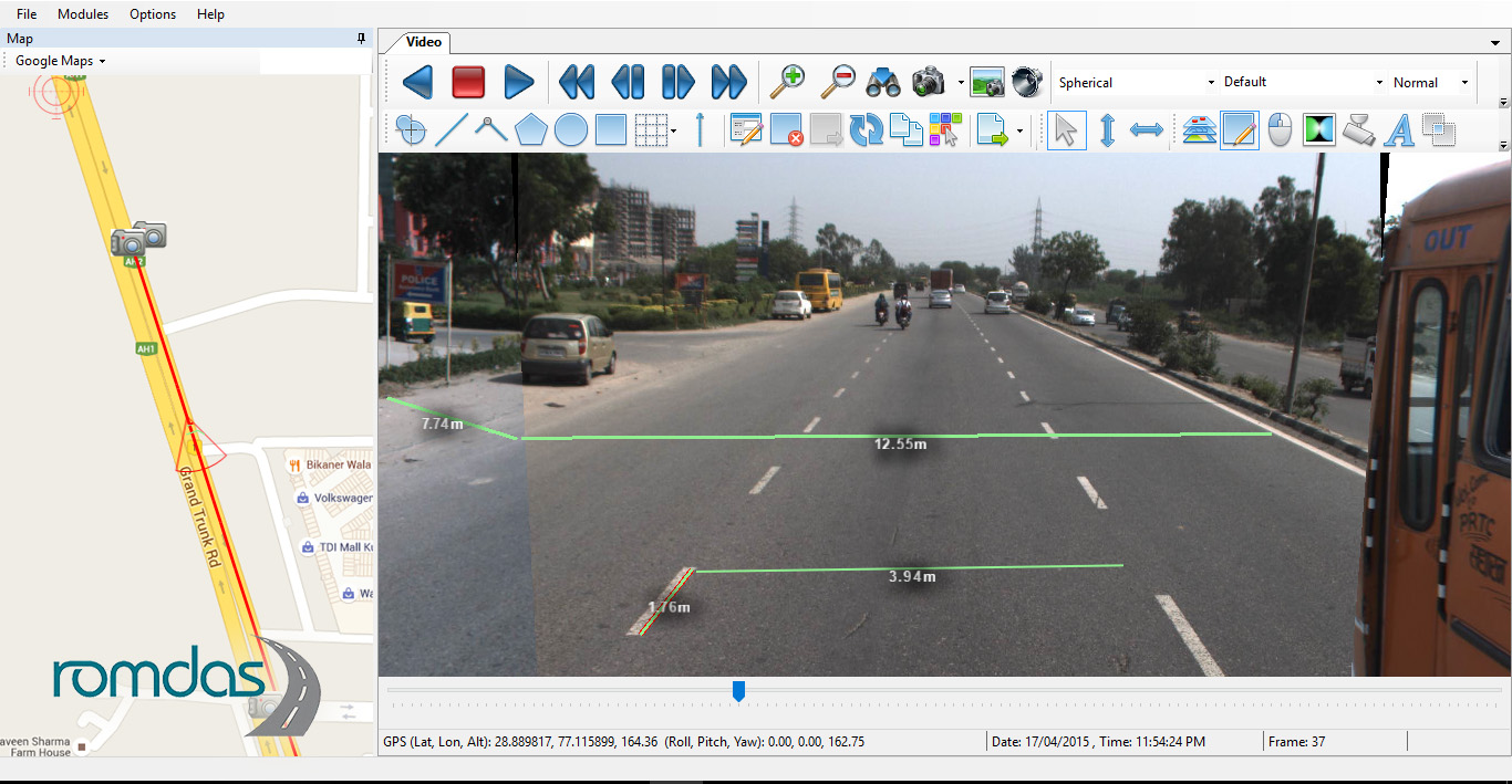
The system utilises standard ROMDAS ROW cameras, rather than a 360 degree camera, which also help ensure the system is very cost-effective while still meeting the local accuracy requirements. The information extracted from the mobile mapping software is then automatically added to GIS map layers creating interactive, detailed and user friendly maps of the road network. Data is also exportable in a number of formats (e.g. .SHP files) and easily added to existing GIS databases.
This new configuration is an excellent option for government departments working on the development of a GIS database for their network, or private companies with an interest in offering mobile mapping services.
If you would like to know if ROMDAS can accommodate your needs and help you achieve your goals, contact us today.